Category: Maps
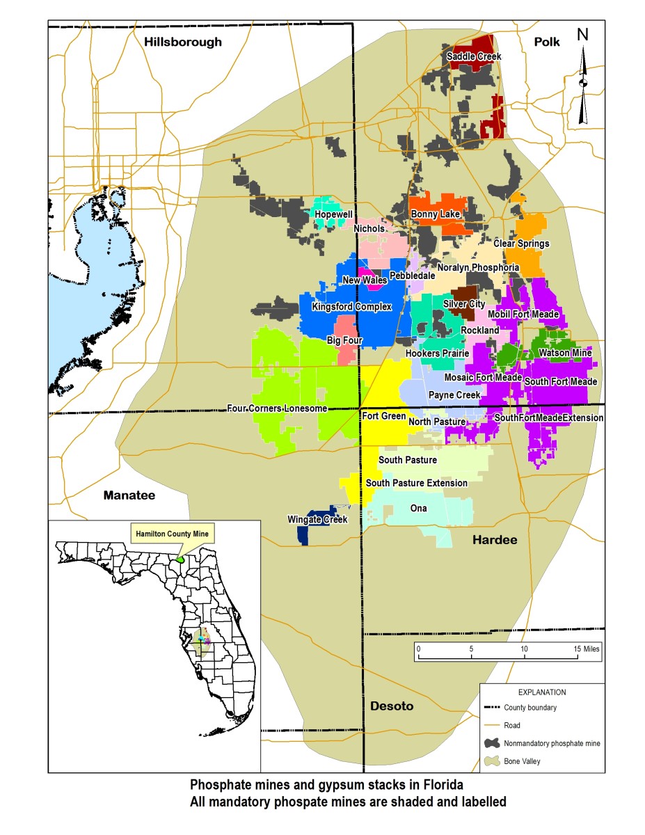
Total phosphate mines and phosphogypsum stacks of Florida
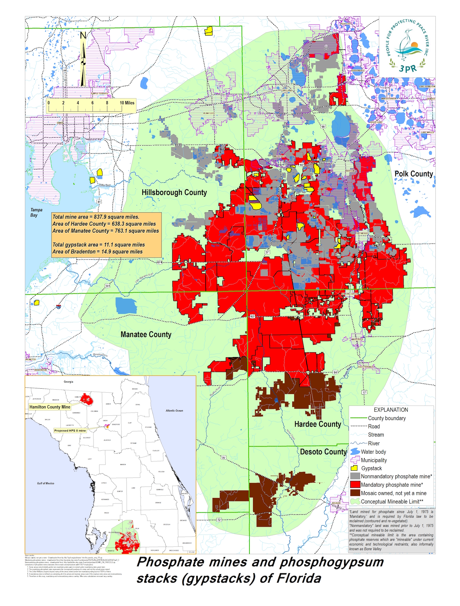
Map of Phosphate mining
1997 Alafia River Acid Spill
Restoration Work Still to Be Completed After Alafia River Acid Spill
The 1997 spill from a fertilizer plant damaged 377 acres of riverine habitat.
Restoration-Work-Still-to-Be-Completed-After-Alafia-River-Acid-Spill
By Tom Palmer
THE LEDGER
Published: Monday, April 2, 2012 at 11:33 p.m.
Last Modified: Monday, April 2, 2012 at 11:33 p.m.
MULBERRY | It’s been nearly 15 years since 56 million gallons of acidic waste water from the now-defunct Mulberry Phosphates fertilizer plant turned the Alafia River into a killing zone.
Much of the river has recovered naturally, as environmental systems eventually do in response to natural or man-made assaults.
But the $3.7 million settlement with Mulberry Phosphates’ insurance company in 2002 included $2.4 million to pay for habitat improvement in the freshwater sections of the river to compensate for the damage.
The December 1997 spill damaged 377 acres of riverine habitat and killed or injured any wildlife that couldn’t get out of the way quickly enough on Skinned Sapling Creek and the North Prong of the Alafia River on the outskirts of Mulberry.
The North Prong begins near Mulberry and joins the South Prong, which begins near Bradley, to form the main river channel in eastern Hillsborough County. The river flows to Hillsborough Bay in Riverview.
But the planned restoration won’t occur in the environmentally damaged land along the river in Polk County. Instead, scientists involved in the restoration planning issued a report in February recommending a restoration project in an environmental preserve about 15 miles southwest of the spill site.
The restoration work will occur in an area known as Stallion Hammock in Hillsborough County’s Balm-Boyette Scrub Preserve, a 4,933-acre public preserve and recreation area south of Brandon. Pringle Branch, a tributary of Fishhawk Creek, flows there. Fishhawk Creek is a tributary of the Alafia River.
The proposal involves restoring wetlands in an area that has been impacted by phosphate mining to improve water quality and wildlife habitat.
The 18-page report mentions other projects in the Mulberry area closer to the actual impact of the spill that were considered and rejected.
The report said the five projects were ruled out either because they involved work on private land or because they may not have produced significant environmental improvements or, if they did, would have required long-term monitoring and maintenance.
John Ryan, a Winter Haven environmentalist who was involved in efforts to make sure restoration occurred in upstream areas, said it doesn’t bother him that the final restoration plan will occur in another part of the river basin.
“It doesn’t make any sense to be parochial,” he said, adding that the important thing is that some restoration will occur.
Florida Department of Environmental Protection spokeswoman Ana Gibbs said the report has been forwarded to the U.S. Fish and Wildlife Service for review.
She said there was no time schedule for getting the work done, explaining that even after the plan gets the go-ahead, it will then require engineering plans and construction bids.
That means the work isn’t likely to occur until at least next year, she said.
[ Tom Palmer can be reached at [email protected] or 863-802-7535. Read his blog on the environment at environment.blogs.theledger.com. Follow on Twitter @LedgerTom. ]
Polk County Reclamation Map
This map shows the state of reclamation in SE Polk County. The red areas are old mines that have not been “released” (properly vegetated in post-mining state) Lakeland is not included in this map. The population center on left top is Mulberry. Top right is Bartow and lower right is Ft. Meade. Bear in mind that Florida Statutes define reclamation as a “temporary use of the land.”
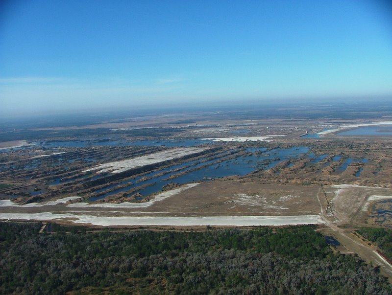
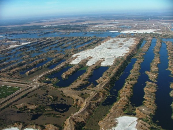
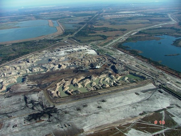
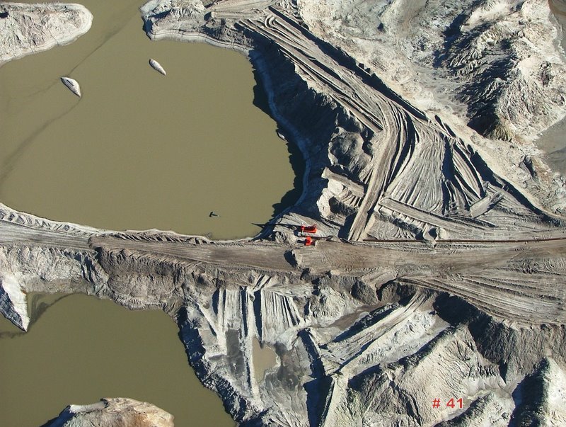
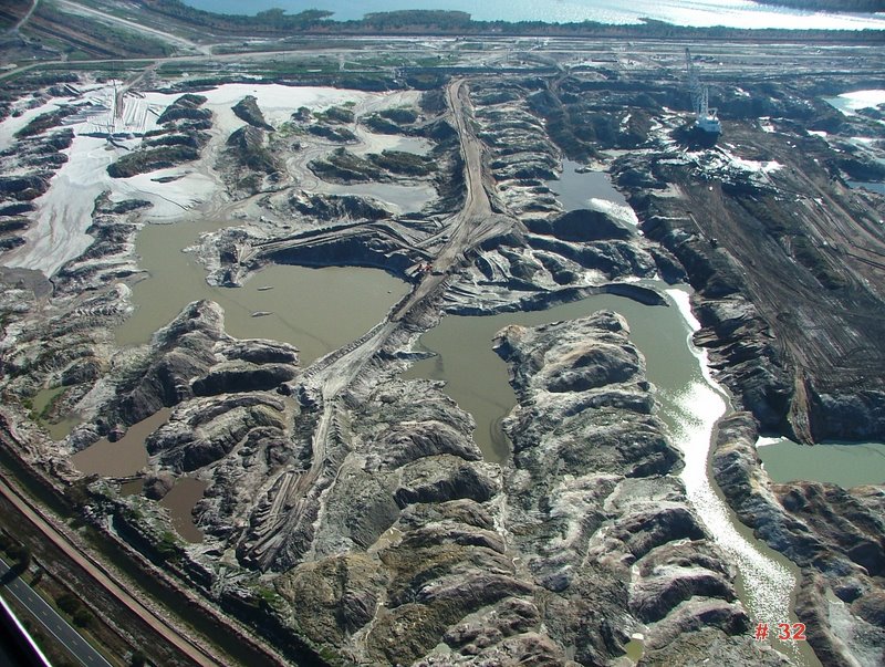
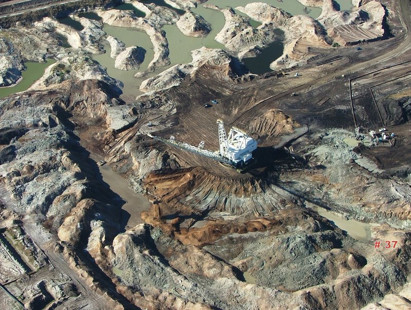
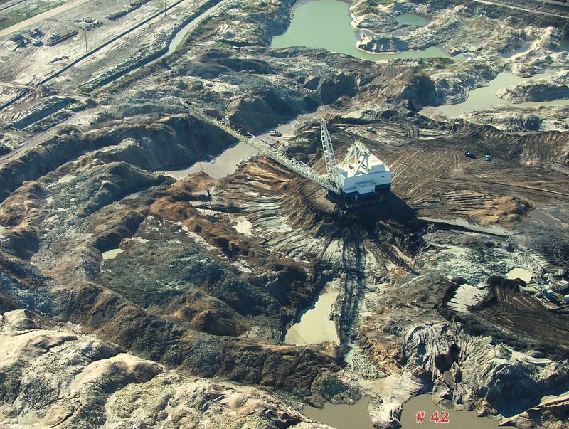
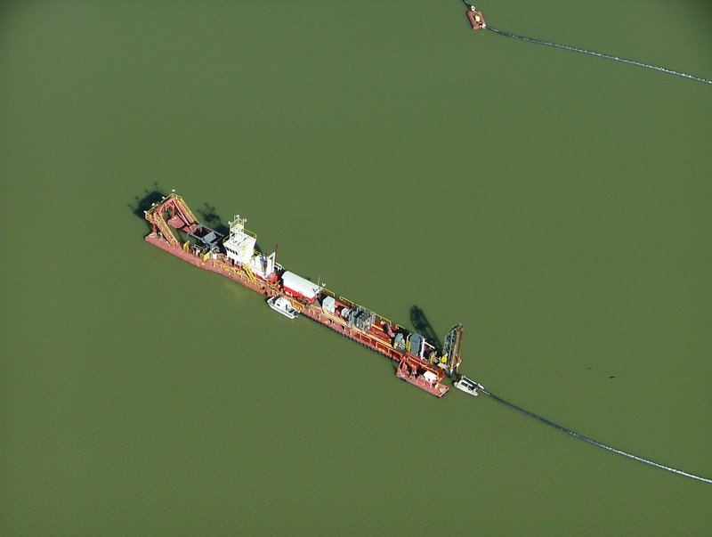
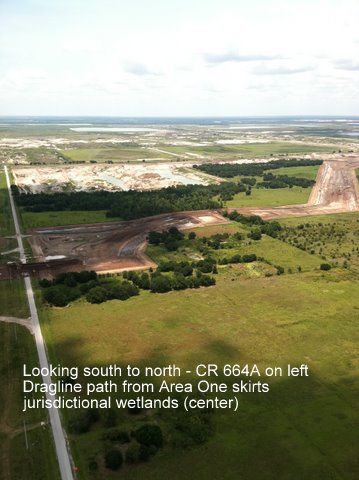
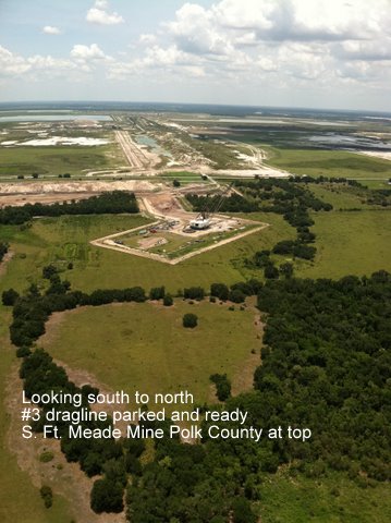
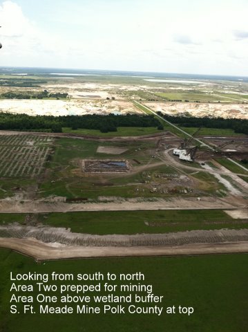
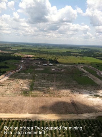
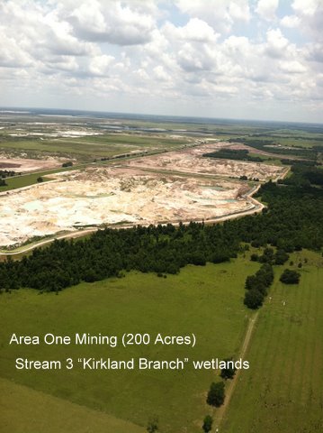
3PR News: Recent Aerial Photos of S. Ft. Meade Mine Extension
These five aerial photos of the S. Ft. Meade Mine Extension/Hardee
were taken on June 22 by an anonymous 3PR pilot.
Area One is the 200 acres conceded to Mosaic in settlement agreement
in exchange for 14.2 acres of bayhead wetlands and 26 acres pasture.
As an unintended consequence of this settlement Mosaic moved 2 draglines east of
jurisdictional wetlands and positioned them to mine additional “upland” acreage
west of CR 664 A, shown in other photos.
The Environmental Plaintiffs are awaiting the District Court’s decision on our
motion to impose an additional preliminary injunction on Area Two.
Mosaic is poised to mine.
Florida Trend Interactive Map – Top 10 FL landowners
This is worth checking out….
http://www.floridatrend.com/wide_article.asp?aID=54802
Florida’s Top 10 Private Landowners
1. Plum Creek Timber
2. St. Joe Co.
3. Foley Timber
4. Rayonier
5. Lykes Bros.
6. Deseret Ranches of Florida
7. Mosaic
8. Bascom Southern
9. Florida Crystals
10. U.S. Sugar
Interactive Map: Florida’s Top 10 Private Landowners & Federal and State Holdings
Theresa Woody
Senior Policy Analyst
South Florida Ecosystem Restoration Task Force
11200 SW 8th Street OE 148
Miami, FL 33199
305-348-1833 office
786-385-0075 cell
________________________________________
******************************************************************
Please note: Florida has a very broad public records law. Most written
communications to or from officials regarding county business, are public records
available to the public and media upon request. Your e-mail communications may
therefore be subject to public disclosure.
******************************************************************
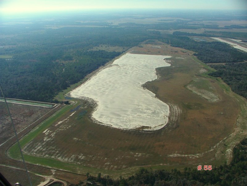
New Altman Tract Photos
Below are some recent photographs of the Four Corners phosphate mine (Altman Tract) – located at the intersection of State Roads 62 and 37 – about 25 miles south of Mulberry. Mosaic fought Manatee County for 8 years to mine these wetlands that are the remaining headwaters of Horse Creek, a major tributary of the Peace River. The Manatee County Commission, upon recommendation for their staff, first denied the Development Order. Mosaic threatened to sue Manatee County for $675,000,000. After an election when two new commissioners were seated, Manatee County capitulated and approved the development order in a revote. Now the only thing standing between the phosphate giant and the mining of these precious wetlands is a Federal lawsuit of the Army Corps of Engineers by Sierra Club, 3PR, Manasota – 88, and the Gulf Restoration Coalition.
The photos were taken by George Chase from an experimental light sport plane.